From Carroll County EMA Director Tim Padgett in coordination with the National Weather Service – Peachtree City office:
BOTTOM LINE UP FRONT / OVERVIEW:
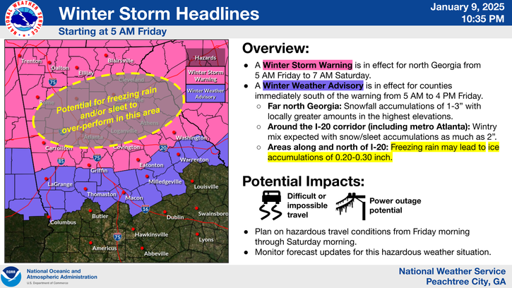
- The Winter Storm Watch has been replaced with a Winter Storm Warning, and a Winter Weather Advisory has been issued in the counties to the south of the warning.
WHAT HAS CHANGED:
- A Winter Storm Warning has been issued across the majority of north Georgia and is in effect from 5 AM Friday to 7 AM Saturday.
- A Winter Weather Advisory has been issued to the immediate south of the Winter Storm Warning and is in effect from 5 AM to 4 PM Friday. (See graphic below)
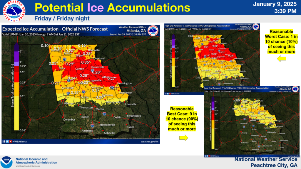
- Forecast ice accumulations have increased and are anticipated to total between 0.2-0.35″ roughly along and north of the I-20 corridor.
WHERE & WHEN:
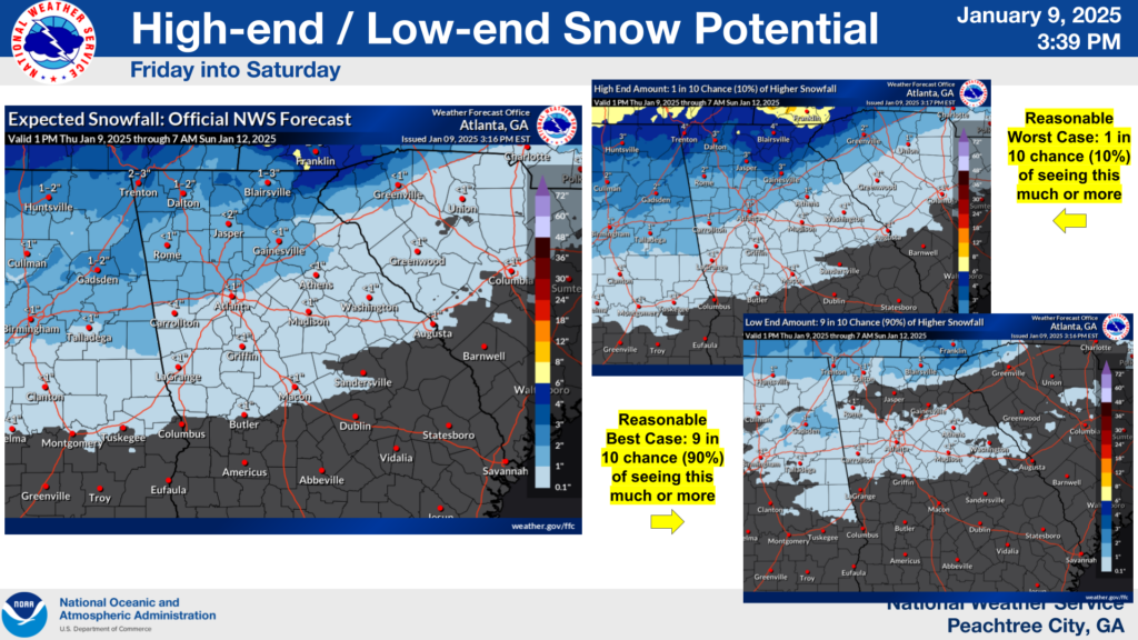
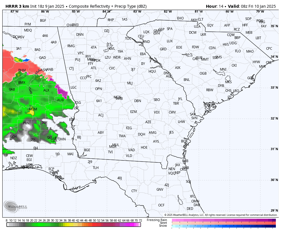
- North Georgia: We anticipate snow to be the primary precipitation type over north Georgia during the morning, however, trends continue to suggest more sleet/freezing rain could mix in during Friday afternoon. This includes the northern portions of the Atlanta Metro Area.
- East Alabama, West Georgia, Metro Atlanta and Eastward: We expect the initial onset to be snow or a wintry mix Friday morning, with a transition to a wintry mix/freezing rain/sleet by early Friday afternoon. Freezing rain is then most likely during the evening, though uncertainty remains with timing of the transition.
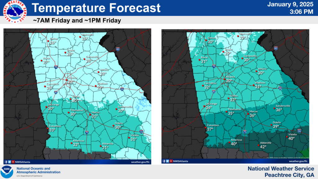
- Central Georgia: We expected the initial onset to be a wintry mix, with a transition to rain by Friday afternoon. If cold air lingers farther south than expected, the freezing rain potential increases over this area.
IMPACTS:
- Expect hazardous travel conditions during this time, especially across north Georgia in the Winter Storm Warning where a prolonged period of ice and/or snow is increasingly likely. Travel is not recommended. The morning commute is expected to be impacted.
- Travel will become hazardous shortly after precipitation onset Friday morning due to the colder ground temperatures leading into the event and temperatures at the onset of frozen precipitation.
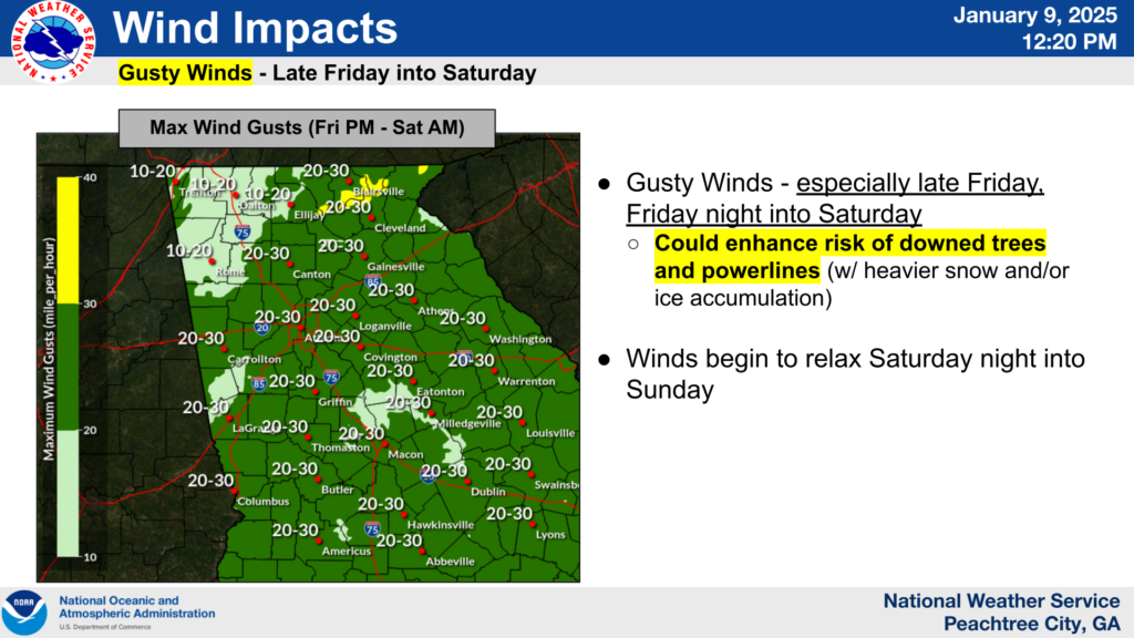
- There is an elevated risk of downed trees and powerlines which would result in power outages, especially considering the increasing ice amounts. Gusty winds with this storm system will increase this risk, particularly on Saturday
FORECAST CONFIDENCE:
- MEDIUM on snow and ice accumulation amounts and the timing of precipitation type transitions.
- HIGH confidence the timing of event onset time, duration, and impacts.
Click on an image below to see a larger version.
