UDATED 3.14.2025 at 2:22PM
From Carroll County Emergency Management and the National Weather Service office in Peachtree City, GA:
HIGHLIGHTS
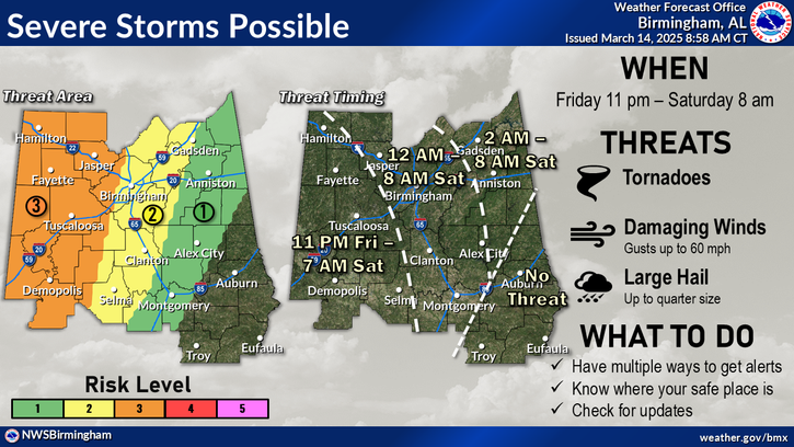
- Significant Severe Weather event expected Saturday evening through Sunday morning across East Alabama and West Georgia.
- Primary Storm Threats
- Damaging winds 60 – 80 MPH
- Tornadoes (some strong/long track)
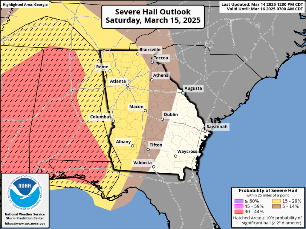
- Hail up to 1 inch in diameter
- Frequent Lightning
POTENTIAL HAZARDS
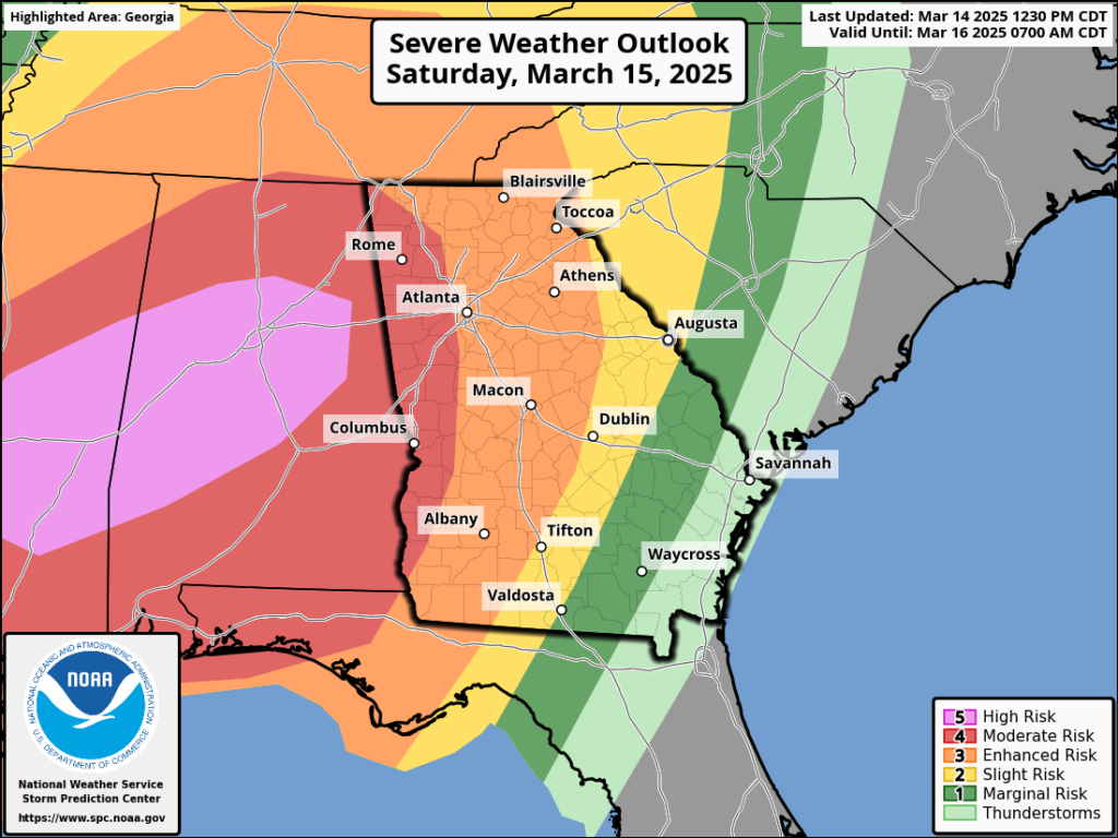
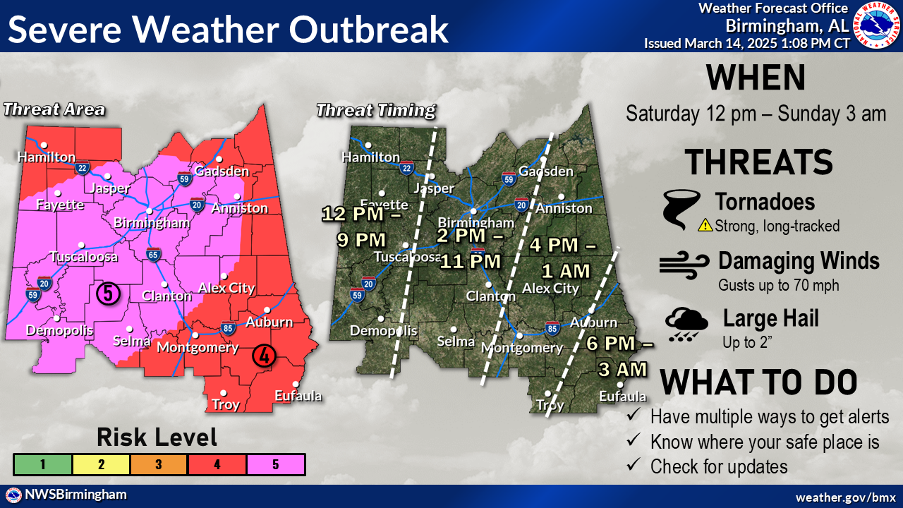
- Moderate Risk (Level 4 out of 5) for severe weather
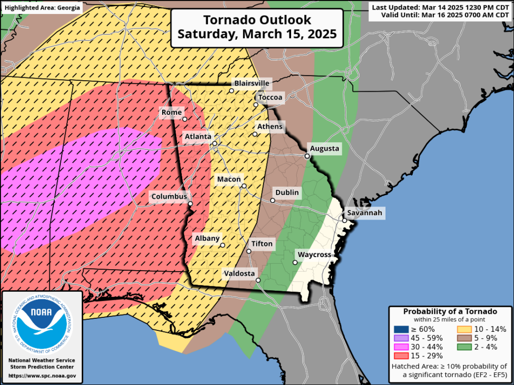
- Greatest risk for supercells/tornadoes (Sat. night) especially west of an Athens to Macon to Americus line.
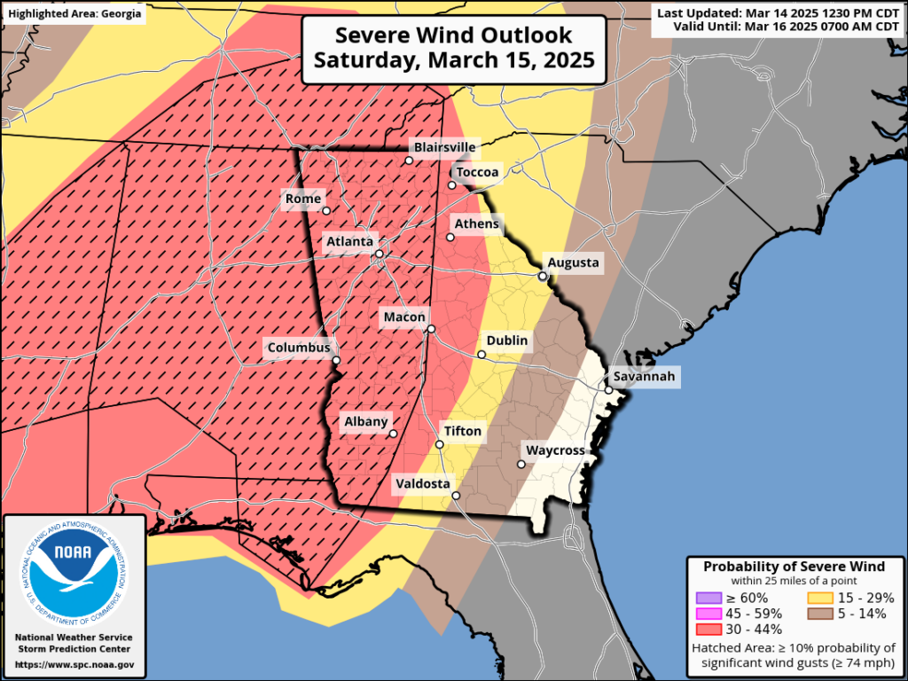
- Damaging Winds 60 – 80 MPH
- Tornadoes (Strong, long track tornadoes possible in East Alabama and West Georgia)
- Chances of seeing a tornado are 25-50 times higher than average for this time of year.
- Large Hail 1 inch in diameter or greater
- Elevated Flood Risk due to Heavy Rainfall
- Frequent Lightning
WINDS
- Damaging Wind Potential is High
- Widespread 60+ mph winds with localized gusts up to 80 mph at 1000 to 3500 feet above the surface.
- Storms will help to bring these winds down to the surface, especially in higher elevations
- Increased risk of downed trees and powerlines
TIMING
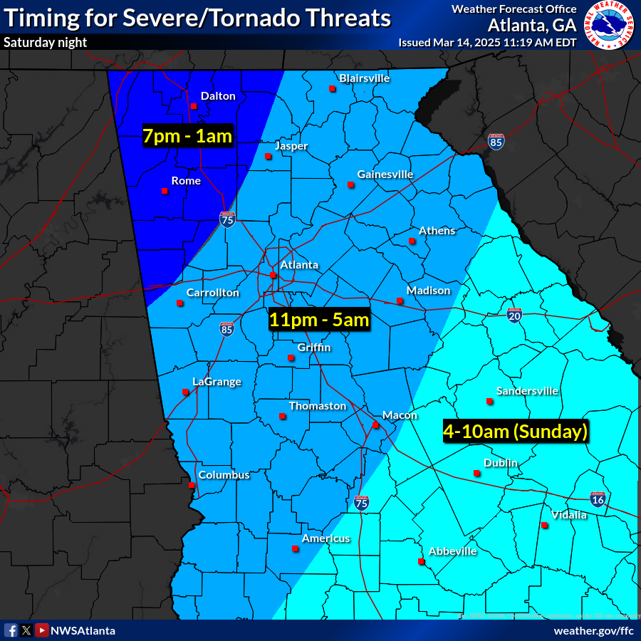
- As early as 5:00pm Saturday through 11:00am Sunday morning.
- Greatest risk: 8:00pm Saturday through early Sunday morning.
SHELTER
- Carroll County will be providing a shelter for those who feel unsafe in their homes during this event. More information will be provided soon.
Please monitor this potentially dangerous weather situation this weekend.
Please see below for additional graphical information and a recording of a special weather briefing from the National Weather Service in Peachtree City.